Barura (Bengali: বরুড়া) is an Upazila of Comilla District in the Division of Chittagong, Bangladesh.Barura is located at 23.3750°N 91.0583°E . It has 52851 units of house hold and total area 241.65 km².
As of the 1991 Bangladesh census, Barura has a population of 310778. Males constitute are 50.05% of the population, and females 49.95%. This Upazila's eighteen up population is 148203. Barura has an average literacy rate of almost 50% (15+ years), and the national average of 47.9% literate.
Census of 2011 shows that Muslims are 91.37%, Hindu 8.44%, Buddhist 0.14%, and others 0.05%. Population density per sq km is 1284.
Religious institutions Mosque 499, temple 98, buddhist vihara 1, Eidgah 134. Noted religious institutions Barura Jami Mosque, Adinamura Mosque and Mazar, tomb of Abdul Hamid (R) at Maheshpur, Barura Central Eidgah and Chandimata Mandir at Chandimura.
Barura thana was established in 1948 and was turned into an upazila in 1983. Earlier Barura thana was a part of the Chandina thana. Barura municipality was established in 1995. The upazila consists of one municipality, 15 union parishads, 231 mouzas and 332 villages.
Educational institutes include College 3, high school 37, junior high school 3, madrasa 35, maktab 300, government primary school 97, non-government primary school 23 and low cost school 15. Noted educational institutions: Barura Shahid Smriti Government College (1972), Payalgachha Post Graduate College, Kadba Talagram T C Laha Multilateral High School (1931), Barura Hazi Nawab Ali Pilot High School (1967), Rajamara Sunnia Madrassa (1944), Barura Alia Madrassa.
Locally published newspapers and periodicals Barura Kantha, Weekly Telephone, Aahaban (extinct). Cultural organisations Club 42, public library 2, theatre party 1, cooperative society 218, community centre 16. Main occupations Agriculture 53.28%, agricultural labour 18.88%, wage labourer 2.22%, commerce 7.96%, service 6.31%, transport 3.26%, and others 8.09%. Land use Total cultivable land 18020.64 hectares single crop 6.73%, double crop 62.74% and treble crop land 30.53%; cultivable land under irrigation 9337.92 hectares.
Land control Among the peasants 22% are landless, 29% small, 38% intermediate and 11% rich. Value of land The market value of the land of the first grade is 20000 Tk per 0.01 hectare. Main crops Paddy, jute, mustard seed, wheat, sesame, betel leaf, hogla leaf and vegetables. Extinct or nearly extinct crops Linseed, kaun, local variety of paddy. Main fruits Mango, jackfruit, coconut, kul, palm and watermelon. Fisheries, dairies, poultries farm Dairy 35, poultry 46.
Communication facilities Roads: pucca road 61 km, semi pucca 10 km and mud road 982 km; railways 0.25 km. Traditional transport Palanquin (extinct), bullock cart (nearly extinct), boat. Manufactories Rice mill 1, brick field 4, cotton mill 1.
Cottage industries Loom 129, bamboo and cane work 746, hogla leaf work 41, jute and wood work 173. Main hats, bazars and fairs Main hats and bazars are 45, the most noted hats and bazars are Barura, Rammahan, Jhalam, Fakirhat, Khosgbas, Maheshpur, Adda, Haripur, Chandimura, Amratali, Payalgachha, Aganagar Hat; noted fairs are Chandimura, Sahapur, Laxmipur and Rammahan Mela. Main exports Betel leaf.
NGO activities Operationally important NGOs are BRAC, ASA, Grameen Bank, Care, proshika, Pages and Health Care Clinic. Health centres Upazila health complex 1, family planning centre 14, satellite clinic 5, private clinic 1 and charitable dispensary 5.
Brahmanpara (Bengali: ব্রাহ্মণপাড়া) is an Upazila of Comilla District in the Division of Chittagong, Bangladesh.
Brahmanpara is located at 23.6167°N 91.1083°E . It has 26493 units of house hold and total area 128.9 km².
As of the 1991 Bangladesh census, Brahmanpara has a population of 161906. Males constitute are 50.98% of the population, and females 49.02%. This Upazila's eighteen up population is 72500. Brahmanpara has an average literacy rate of 32.6% (7+ years), and the national average of 32.4% literate.
Brahmanpara has 8 Unions/Wards, 54 Mauzas/Mahallas, and 84 villages.
Bangladesh Academy for Rural Development (BARD) (Bengali: বাংলাদেশ পল্লী উন্নয়ন একাডেমী (বার্ড)) is an autonomous institution that strives for research and training of local people as well as practitioners on rural development. The Academy is known for implementing Comilla Model in 1960s that has been internationally recognised as a model project for rural development in the developing countries.
BARD was established in 1959 in Comilla (as Pakistan Academy of Rural Development), under the initiative of Dr Akhtar Hameed Khan who became the institution's founder-Director. After the Partition of Pakistan, the institution was renamed to its present form.
The Academy is located at Kotbari, 10 km from Comilla town. The campus is spread over a vast area that also hosts residences, conference rooms, mosque, library, a health clinic, sports complex, and other amenities.
One of the main functions of BARD is to provide training for both officials and non-official members of the public and private institutions working on rural development. The training is provided in the form of courses, visit programmes, workshops and seminars.
The research is basically aimed at collecting socio-economic data for planning and project preparation. Findings are also used for training and information materials by respective public bodies and planning institutions. Research also relate to the evaluation of national rural development programmes either independently or jointly with government agencies, universities and research organisations.
Burichong (Bengali: বুড়িচং) is an Upazila of Comilla District in the Division of Chittagong, Bangladesh.Burichong is located at 23.5500°N 91.1264°E . It has 37739 units of house hold and total area 163.76 km².
Raghunath Tarkavachaspati,a Bramhin scholar in the subject of logic migrated from Dingshai village now in West Bengal in the 17th century to establish the village of Burichong on the land granted to him by Chatra Manikya [Nakshatra Rai] the Maharaja of Tripura to start a Toll (an institute for vedic learning).
As of the 1991 Bangladesh census, Burichong has a population of 228479. Males constitute are 51.68% of the population, and females 48.32%. This Upazila's eighteen up population is 106787. Burichong has an average literacy rate of 34.3% (7+ years), and the national average of 32.4% literate.
Burichong has 8 Unions/Wards, 152 Mauzas/Mahallas, and 171 villages.
The Board of Intermediate and Secondary Education (BISE), Comilla, has been established in the year 1962 under The East Pakistan Intermediate and Secondary Education (Amendment) Ordinance, 1962.
According to the ordinance of the board, The East Pakistan Intermediate and Secondary Education Ordinance, 1961 (East Pakistan Ordinance No. XXXIII of 1961) and its amendments No. XVI of 1962 and No. XVII of 1977, it is responsible for the organization, regulation, supervision, control and development of Intermediate and Secondary level public examinations and educational institutions.
Chandina (Bengali: চান্দিনা) is an Upazila of Comilla District in the Division of Chittagong, Bangladesh.
Chandina is located at 23.4833°N 91.0083°E . It has 46856 units of house hold and total area 201.92 km². Chandina township is a class B municipality, which is located at the extreme north of the upazilla by the Dhaka Chittagong Highway. Cahndiara village area is within the municipality and value of property here, like the rest of the municipality, have increced significantly.
Chandina, due to fartile land and less flood zones, is one of the most densely populated rural areas of the world. As of the 1991 Bangladesh census, Chandina has a population of 269878. Males constitute are 50.18% of the population, and females 49.82%. This Upazila's eighteen up population is 127010. Chandina has an average literacy rate of 27.7% (7+ years), and the national average of 32.4% literate.
Chandina has 1 class B municipality 12 Unions, 126 Mauzas/Mahallas, and 232 villages.
Chauddagram (Bengali: চৌদ্দগ্রাম) is an Upazila of Comilla District in the Division of Chittagong, Bangladesh.
Chauddagram is located at 23.2167°N 91.3167°E . It has 57435 units of house hold and total area 268.48 km².
As of the 1991 Bangladesh census, Chauddagram has a population of 332055. Males constitute are 49.83% of the population, and females 50.17%. This Upazila's eighteen up population is 154720. Chauddagram has an average literacy rate of 33% (7+ years), and the national average of 32.4% literate.
Chauddagram has 14 Unions/Wards, 414 Mauzas/Mahallas, and 418 villages.
Comilla Cadet College is a military high school in Bangladesh.
Comilla Cadet College (CCC) was founded near Moinamoti Bouddha-bihar in Kotbari, Comilla on 1 July 1983. It was the most recent of the ten cadet colleges until the establishment of two girls' cadet colleges in Feni and Jaipurhat. Like the other five post-Bangladesh Liberation War cadet colleges, CCC was converted from a boarding school. The campus was renovated within nine months by a panel of educators and military officials including founding principal Lt. Col. Nurul Anwar (now retired), Vice-Principal Ashraf Ali, Nurul Haque, Taslim Uddin, Akhtar Alam, Humayun Kabir, Abdul Jabbar and Kamal Uddin Mohammad. The Adjutant General of the Bangladesh Army, Maj. Gen. Abdus Samad psc, opened CCC on 7 April 1984 with 150 cadets in three random groups. On 18 May a fourth group, and on 22 November a fifth, followed. The arrival of a sixth group late in the year met the enrollment goal of 300.
Despite its brief history, CCC is a notable institution for pre-university education in Bangladesh. A military preparatory school, many CCC graduates have joined the country’s armed forces; some have achieved accolades such as the Sword of Honor or Osmani Shornopodok at Bangladeshi military institutes. Academically, few other schools in the region are its peer; CCC cadets have secured more than 15 top positions in the national high school tests in a single year.
CCC is located in Kotbari, Comilla, about 8 km from the center of Comilla. A paved road connects the campus with town and points of interest in the vicinity. Most of the college’s land and buildings are surrounded by concrete walls with patrolled gates. CCC owns approximately 52 acres (21 ha) of land, including cadet dormitories known as "houses", staff quarters, academic buildings, a mosque, dining hall, storage facilities, a hospital, a fish pond, sports facilities and administrative offices. The campus is largely self-contained; however, seriously-ill cadets are provided care at the nearby Combined Military Hospital (CMH).
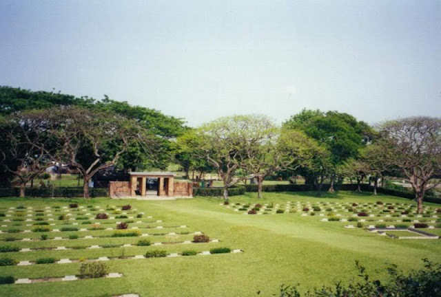
Comilla is a major city in eastern Bangladesh, and is home to half a million people. It is known for its scenic beauty, rolling hills, tropical woods, sweet delicacies, high literacy rate and its military garrisons. CCC is located in the nearby suburb of Kotbari. Surrounding the campus are picnic areas, forests, the Bangladesh Academy for Rural Development (BARD), a World War II cemetery, and the Mainamati-Lalmai historical complex.
Mainamati-Lalmai was the center of a Buddhist civilization which flourished from the seventh to the twelfth centuries AD. As many as 50 archeological sites have been identified, which some have been excavated from a range of low hills known as the Mainamati-Lalmai Ridge. The excavations have archeological and cultural importance especially in the field of Buddhist studies. The area features a museum with a collection of historical artifacts found at the excavation sites. In addition to tours, the cadets can see the museum and the historic site from their dormitories.
The college's residential building is three-storied with cadets from each of the three houses on each floor. The dining hall is located on a hill, near the mosque and hospital. An H-shaped academy block hosts the classrooms, teachers' rooms and auditorium. It was designed by Adnan Islam, an employee of the Mitsubishi engineering department.Comilla Cadet College has earned a reputation as one of the country's best educational institutions. Every year, the college achieves outstanding results in the SSC and HSC examinations.
Comilla City Corporation is a self-governed municipal administration in Bangladesh that administers and oversees development and maintenance works in the city of Comilla. The corporation covers an area of over 33 square kilometer in the Comilla district where over five million people live as permanent residents. The body was known as Comilla Municipality previously, until it obtained the City Corporation status by a ministry of local government declaration on 10 July 2011.
History of the Comilla municipal region dates back to 1790 as a new Tripura district was formed comprising the adjacent areas of today's Comilla district. Upon administrative reforms after the 1947 independence as Pakistan, the district was renamed as Comilla district as the main Tripura district remained in the Indian territory, as the center of today's state of Tripura in India. Today's Brahmanbaria and Chandpur district at that time have been two sub-districts (upazila) of Comilla district.
The Comilla municipality was formed in mid 1890s and the city remained as a municipality for over 125 years though the number of people living in here and the density of population, both have been rising with time. An administrative proposition, issued from the Comilla district administration, was passed on 20 August 2009. A ministry of local government meeting on 4 March 2011 declared to turn at least four of the populated municipalities into city corporations, largely bringing Comilla as a suggestion as one of the contenders.
An administrative move was made on 23 June 2011 abolishing the Comilla Municipality as the final step to introduce the administrative body as a city corporation. Later on 10 July 2011, a ministry gazette named the Comilla Municipality as the new Comilla City Corporation.
The city corporation is run by a joint staff of elected public representatives and government officials. Officials both come from departmental recruitment and the administrative cadre service of the country. On the other hand representatives comprise the mayor as the cabinet leader, a councilor for each ward and a special woman councilor for each three wards. This makes the elected cabinet of Comilla City Corporation to have 37 members, containing 27 councilors, 9 woman councilors led by the mayor.
Bangladesh Election Commission is constituted to oversee city corporation polls and election of the cabinet, which sits in the office for a five-year tenure. A new local government bill by the government does not allow a cabinet to sit in the office for a day more than five years. Rather it accommodates the provision to appoint a government official as the administrator of the corporation, to oversee routine municipal works in a temporary basis.
The first ever mayoral election of Comilla City Corporation was held on 5 January 2012, where a total of 127,772 voters out of some 169,000 elected the municipality’s Monirul Haque Sakku as its new mayor. Sakku won the election getting 51.32% votes beating Afzal Khan by 29,106 votes as his closest opponent.
The same election elected 27 councilors and 9 woman councilors from 27 wards.
The defeated mayoral aspirant Afzal Khan was officially backed by his party Awami League, whereas Monirul Haque Sakku, being a veteran Bangladesh Nationalist Party leader in Comilla, had to take a leave from the party as BNP had decided earlier to abstain any election held under the rule of its rival Awami League due to political differences.
However Sakku, following his victory in the election, clarified that his departure from the party was a ‘strategic move’ to maintain the party position and to challenge the government party on popularity simultaneously.
Comilla Medical College is a medical college in Comilla, Bangladesh. It is situated in the village Kuchaitoli at the border of Comilla city corporation beside EPZ road also known as medical college road. It is a government medical college that admits 110 students into the five-year MBBS degree programme. It was first established in 28 May 1979 by late president Ziaur Rahman, later closed in 1982 due to political change. It was reestablished in 1992. On 15 August 1992 prof. dr. Habibur Rahman Ansari, first principal started academic classes with 50 students and 11 teachers from 2 depertments only. Now it is a well decorated institution with 500-bed hospital, 2 boys hostel and 3 girls hostel in 25 acres area. As of May 2012, 16 batches have completed their bachelor degrees. Some foreign students from pakistan, nepal and kashmir are studying in this institution. Officially it is a student politics free institution. Non political organization such as Medicine club, Sandhani, ADHUNIK, Rotaract club, Leo club is active among the students. Chatro kollan porishod or Student welfare comity deals with the student affairs. A nice playground for boys, a large auditorium, a well furnished liabrary increased its reputation. In the leaderboard of professional exam under Chittagong University it occupy most places regularly. This institution has 24 hour water supply and electricity supply is about cent per cent.
Comilla Polytechnic Institute (CPI) (Bengali : কুমিল্লা পলিটেকনিক ইন্সটিটিউট) is a largest and reputed Government polytechnic institute in Kotbari, Comilla, Bangladesh which was established in 1962.
Comilla Polytechnic Institute (CPI) is a largest and reputed Government polytechnic institute in Kotbari, Comilla, Bangladesh which was established in 1962. This polytechnic has controlled by the Government of Bangladesh and under the Bangladesh Technical Education Board (BTEB).
Comilla Polytechnic Institute (CPI) provide 4 years Diploma in Engineering Course under the Bangladesh Technical Education Board (BTEB) by maintaining International Standard of Diploma Engineering course.
There are six departments in CPI (Comilla Polytechnic institute)
- Computer Technology
- Civil Technology
- Electrical Technology
- Electronics Technology
- Mechanical Technology
- Power Technology
Comilla Victoria College (Bengali: কুমিল্লা ভিক্টোরিয়া কলেজ) is a college in Comilla, Bangladesh. It is one of the oldest and renowned colleges in Comilla as well as in Chittagong division. The college is located on 29 acres of land including its intermediate and honors section. “Dr Akhtar Hameed Khan [World-renowned social scientist] was invited by the Government of Pakistan to take charge as Principal of Victoria College in Comilla, East Pakistan [now Bangladesh]. He accepted the invitation and stayed at this position until 1958, with a break in 1954-55 when he joined as a Director of the Village Agricultural Industrial (Village-Aid) Program in East Pakistan”.
Landlord of that time, Roy Bahadur Anandra Chandra Roy, established the college on 24 September 1899. Anandra Chandra Roy was a renowned patron of promoting and developing education in the district. He was a contractor by profession and accordingly set aside a large amount of money to establish a college for the development of higher education in Comilla. Comilla Victoria College was thus born to fulfill his long cherished dream. In recognition of his noble endeavour, the British Government awarded him the title “Roy Bahadur” after the establishment of the college. A white sculpture was built in front of the main gate of intermediate section of the college to keep the memory of Roy Bahadur alive. Queen Victoria was the empress of India from 1876 to 1901. At that time, Comilla was under the rule of the empire, hence the college was named as Comilla Victoria College.
Sattendranath Boshu was the first principal of the college. He was the headmaster of former Comilla Victoria School. He remained the principal of the college until his death. He was a scholar as well as a researcher of literature. He was also a professor of English and was awarded Rabindranath Prize for his outstanding contribution to literature. Prof. Fazlul Karim was the first Muslim teacher of this college in 1937. He later became the Vice Prinncipal of the college in 1958 until his retirement in 1972 when the college was made a government college.
Victoria College is located on 29 acres (120,000 m2) of land including its intermediate and honors section.
There are 129 teachers in this college against 150 posts. But this small number of teachers is not sufficient address such a huge number of students. The total number of departments of the college stands at 18. The departments are Accounting and Management department of Business faculty, Physics, Chemistry, Biology, Zoology, Botany, Mathematics, Statistics of Science faculty and English, Social Science, Social Welfare, History, Islamic History, Political Science, Economics, Philosophy and Arabic of Arts faculty. At present, the college has 15,000 students and 147 teachers, of whom 36 are women.
The college always stands first in Comilla Board on the basis of good result in HSC. Meritorious students try to get admission in this college because of its name and fame. Students of the Honours section also do very well in examinations. Most of the time students of this college get top positions in exams held under the national university.
Students of the college regularly take part in debate. They won many prizes from BTV and others debate competitions. Bangladesh National Cadet Core (BNCC), Rover Scouts are also working at the college. Sandhani and Badhon, two leading blood donation organizations of the country, regularly organise blood donation programmes on the campus where students and teachers participate voluntarily.
Comilla Victoria College has five dormitories: four for boys and one for girls. About 1,000 students reside in these dormitories.
Daudkandi (Bengali: দাউদকান্দি) is an Upazila of Comilla District in the Division of Chittagong, Bangladesh.
Daudkandi is located at 23.5333°N 90.7167°E . It has 77102 units of house hold and total area 376.23 km².
As of the 1991 Bangladesh census, Daudkandi has a population of 458503. Males constitute are 50.44% of the population, and females 49.56%. This Upazila's eighteen up population is 215409. Daudkandi has an average literacy rate of 29.9% (7+ years), and the national average of 32.4% literate.
Debidwar (Bengali: দেবীদ্বার) is an Upazila of Comilla District in the Division of Chittagong, Bangladesh.
Debidwar is located at 23.6000°N 90.9917°E . It has 55619 units of house hold and total area 238.36 km².
As of 1991 Bangladesh census, Debidwar has a population of 336877. Males constitute are 50.33% of the population, and females 49.67%. This Upazila's eighteen up population is 158356. Debidwar has an average literacy rate of 35.1% (7+ years), and the national average of 32.4% literate.
Homna (Bengali: হোমনা) is an Upazila of Comilla District in the Division of Chittagong, Bangladesh. It is famous for its natural beauty and some historic sites. People of Homna fought bravely in Bangladesh Liberation War in 1971. Homna thana (now an upazila) was established in 1918.
Homna is located at 23.6833°N 90.7917°E. It has 36814 units of house hold and total area of 180.13 km². The river Meghna and branch of Titas named Sativanga passes through Homna.
As of the 1991 Bangladesh census, Homna has a population of 211,563. Males constitute 50.21% of the population, and females 49.79%. This Upazila's eighteen up population is 99,699. Homna has an average literacy rate of 21.9% (7+ years), and the national average is 32.4%.
Homna has 10 Unions/Wards, 95 Mauzas/Mahallas, and 207 villages.
Laksam (Bengali: লাকসাম) is an Upazila of Comilla District in the Division of Chittagong, Bangladesh. Laksam has 25 Unions/Wards, 484 Mauzas/Mahallas, and 504 villages.
Laksam Upazila (comilla district) with an area of 429.34 km2, is bounded by Comilla Sadar and Barura upazilas on the north, chatkhil, begumganj and senbagh upazilas on the south, nangalkot and chauddagram upazilas on the east, Barura and shahrasti upazilas on the west. Main rivers are Dakatia and Little Feni.
Laksam (Town) consists of 9 wards and 31 mahallas. The area of the town is 14.3 km2. It has a population of 60926; male 52.31%, female 47.69%; density of population is 4261 per km2. Literacy rate among the town people is 38.3%. Laksham is well known as a commercial town.
Laksham thana was turned into an upazila in 1982. The upazila consists of one municipality, 9 wards, 2 police outposts, 25 union parishads, 479 mouzas and 504 villages.
Slaughter place at Beltala of Laksham Railway Junction and a mass grave near the Harishchar Chaurasta.
Mosque 960, temple 18, Buddhist Vihara 2, tomb 7, most noted are tomb of Gazi Shaheb, Darbar Sharif at Panua, tomb of Pir Shaheb at Kaliapur, tomb of Syed Shah Waliullah Rajapuri Pir Saheb at Rajapur and Buddhist Vihara at Baraigaon.
Average literacy 34.4%; male 40.7% and female 28.4%. Educational institutions: college 2, high school 64, junior high school 5, madrasa 59, government primary school 432, non-government primary school 69, satellite school 11, BRAC school 145. Noted educational institutions: Nawab Faizunnesa Government College,Nawab Faizunnesa & badrunnesse high school, Laksham Pilot High School, Laksham Girls High School,Laksam Ralway A Malek Institution,Norpati High School, Norpati Government Primary School, Harishchar Union High School, Daulatganj Government Primary School, Gazimura Alia Madrasa.
Muradnagar (Bengali: মুরাদনগর) is an Upazila of Comilla District in the Division of Chittagong, Bangladesh.
Muradnagar is located at 23.6385°N 90.9325°E . It has 72320 units of house hold and total area 339 km².hii Bakhrabad Gas Systems Limited's gas mine is here.
As of the 1991 Bangladesh census, Muradnagar has a population of 417204. Males constitute are 50.31% of the population, and females 49.69%. This Upazila's eighteen up population is 195286. Muradnagar has an average literacy rate of 30.6% (7+ years), and the national average of 32.4% literate. DIGER PAR Gonjar.
Muradnagar has 22 Unions/Wards, 155 Mauzas/Mahallas, and 301 villages.
Mainamati (Bengali: ময়নামতি Môenamoti) is an isolated low, dimpled range of hills, dotted -with more than 50 ancient Buddhist settlements of the 8th to 12th century A.D. It is extended through the centre of the district of Comilla. Mainamoti is located almost 8 miles from the town of Comilla, Bangladesh. It is the home of one of the most important Buddhist archaeological sites in the region. There are a number of Buddhist sites in this region, dating approximately from 7th to 12th centuries CE. Comilla Cantonment is located nearby and houses a beautiful colonial era cemetery.
Mainamati is named for the Candra queen of the same name, mother of the Govindachandra.
The centre piece of the Buddhist sites at Mainamati is the Shalban vihara, almost in the middle of the Mainamati-Lalmai hill range consists of 115 cells, built around a spacious courtyard with a cruciform temple in the centre, facing its only gateway complex to the north, resembling that of the Sompur Bihara. It is clearly a Vihara, or an educational centre with residential facilities.
Kutila Mura situated on a flattened hillock, about 5 km north of Salban Vihara inside the Comilla Cantonment is a picturesque Buddhist establishment. Here, three stupas are found side by side representing the Buddhist "Trinity" or three jewels, i.e. the Buddha, Dharma and Sangha.
Charpatra Mura is an isolated small oblong shrine situated about 2.5 krn. north-west of kotila Mura stupas. The only approach to the shrine is from the East through a gateway which leads to a spacious hall. Here a number of shrines can be found.
The Mainamati site Museum, situated next to Salvan Bihara, houses a good collection of artifacts found at these sites. The Mainamati site Museum has a rich and varied collection of copper plates, gold and silver coins and 86 bronze objects. Over 150 bronze statues have been recovered mostly from the monastic cells, bronze stupas, stone sculptures and hundreds of terracotta plaques each measuring on an average of 9" high and 8" to 12" wide.
Mairiamati is only 114 km. from Dhaka City and is just a day's trip by road on way to Chittagong.
Nangalkot (Bengali: নাঙ্গলকোট) is an Upazila of the Comilla District in the Division of Chittagong, Bangladesh.
Nangalkot Upazila (comilla district) with an area of 236.44 sq km, is bounded by laksham and chauddagram upazilas on the north, senbagh and daganbhuiyan upazilas on the south, Chauddagram upazila on the east, Laksham upazila on the west. River little feni, Hara Khal (canal), Trishna Beel, Aichha Dighi (pond), Nandeshwar Dighi and Gotrashala Dighi are notable.
Nangalkot (Town) consists of 3 mouzas. The area of the town is 3.25 sq km. It has a population of 5115; male 55.41% and female 44.59%; population density per sq km 1573. Literacy rate among the town people is 40.9%. The town has two dakbungalows.
Nangalkot thana was turned into an upazila in 1983. The upazila consists of 11 union parishads, 213 mouzas and 285 villages.
Shalban vihara (Sanskrit; Bengali: সোমপুর বিহার Shalbon Bihar) in Moinamoti, Comilla, Bangladesh is one of the best known Buddhist viharas in the Indian Subcontinent and is one of the most important archeological sites in the country.
At the last of 8th century,king Vobodev made the "Salbon Bihar" in this place.The digging started from 80th decades.
Many archeological elements were found here. Most of them are kept in the Moinamoti Museuam now.


 Arjuntala Jamey Masjid, Barura Upazila, Comilla, Bangladesh


 A Street in Brahmanpara, Comilla, Bangladesh


 Bangladesh Academy for Rural Development, Comilla, Bangladesh


 Burichong Upazila, Comilla Bangladesh


 Board of Intermediate and Secondary Education (BISE), Comilla


 Chandina Upazila, Comilla, Bangladesh


 Chauddagram Upazila, Comilla, Bangladesh


 Comilla Cadet College Academic Block
 Comilla Cadet College
 New Office of Comilla City Corporation


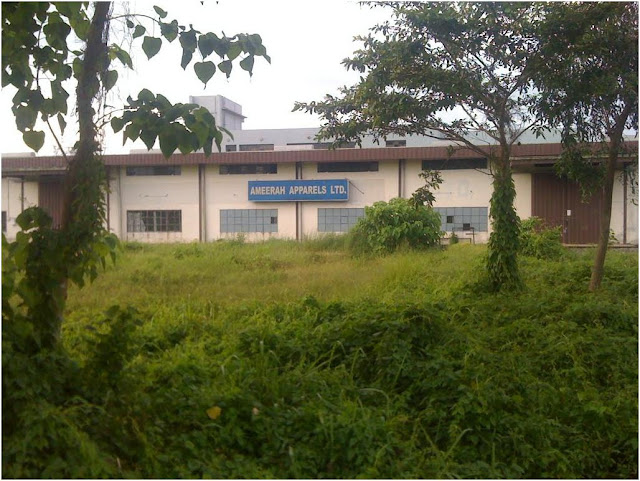


 Comilla Medical College

 Comilla Polytechnic Institute (CPI) in Comilla, Bangladesh

 Comilla Victoria College


 Comilla Victoria College Campus


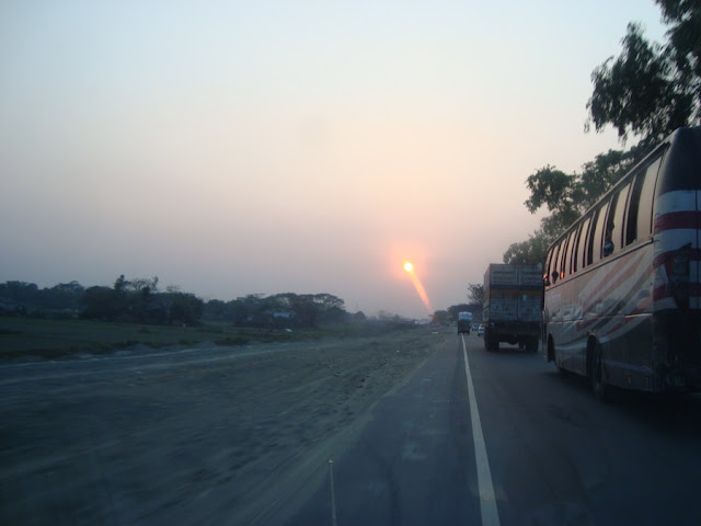


 Daudkandi Bazar, Comilla, Bangladesh


 Debidwar, Comilla, Bangladesh


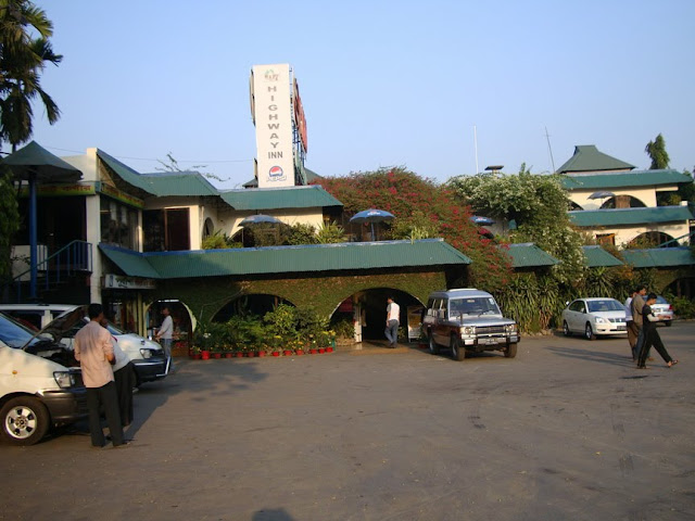


 Homna Bus Stand, Comilla, Bangladesh


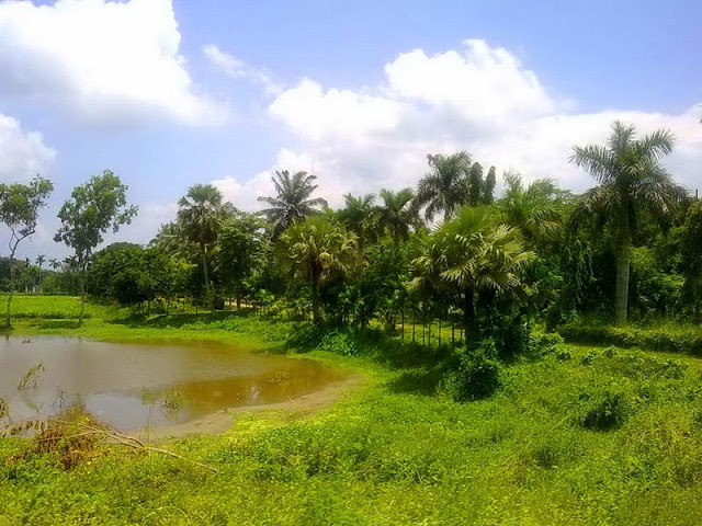


 Laksam Railway Junction, Comilla, Bangladesh

 Union Council Office in Muradnagar, Comilla, Bangladesh
 Mainamati Archaeological Site, Mainamati, Comilla, Bangladesh


 Nawab Faizunnesa Masjid in Laksam, Comilla, Bangladesh
 Nawab Faizunnisa Palace Gate in Laksam, Comilla, Bangladesh
 Nangalkot, Comilla, Bangladesh
 Nangalkot, Comilla, Bangladesh


 Railway High School Masjid in Laksam, Comilla, Bangladesh
 Railway Track in Laksam, Comilla, Bangladesh


 Ruins of Shalban Bihar Tamples in Comilla, Bangladesh








No comments:
Post a Comment