 |
| Chandpur, Bangladesh |
Chandpur (Bengali: চাঁদপুর) (Urdu and Punjabi: چاندپور) is a district in east-central Bangladesh, located at the mouth of the Meghna River.
Chandpur district is administered by Chittagong Division, the second largest of Bangladesh's seven administrative divisions.
Geography:
Chandpur district has a total area of 1,704.06 kilometers-squared (1,058.85 mi).
The district is bound by Munshiganj District and Comilla District to the north; Noakhali District, Lakshmipur District and Barisal District to the south; Comilla District to the east; and the Meghna River, Shariatpur District and Munshiganj District to the west.
 |
| Dakatiya River, Chandpur, Bangladesh |
Chandpur is a conflux of two major rivers, the Padma River (the main branch of the Ganges River) and the Meghna River, which converge near Chandpur town. Several significant tributaries of the Meghna River flow through Chandpur district. These include the Dakatia River, Dhanagoda River, Matlab River and Udhamdi River.
Administration:
In December 2011, the Bangladeshi government appointed Lieutenant Colonel (Rtd.) Abu Osman Chowdhury, a local leading member of the Bangladesh Awami League, as the administrator to the Chandpur district council.
A Deputy Commissioner (DC) of the Bangladeshi government's Cabinet Division, Priyatosh Saha, is responsible for Chittagong division's Chandpur district.
 |
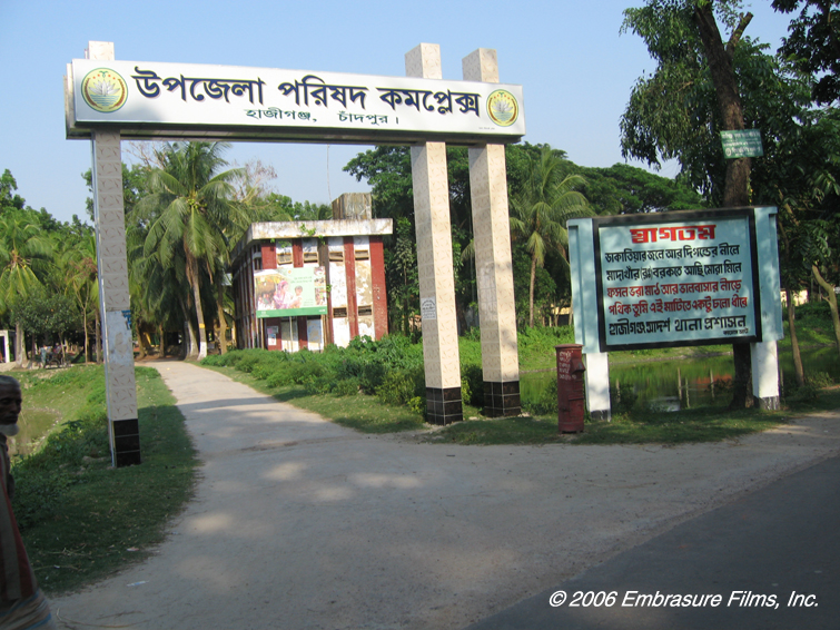
| Hajiganj, Chandpur, Bangladesh |
Subdivisions
Chandpur district is made up of 6 municipalities, 60 wards, 195 mahallahs (sub-divisions), 8 upazilas (administrative sub-districts), 8 thanas (administrative police districts), 87 Union Councils of Bangladesh (rural administrative districts) and 1226 villages.
The 6 municipalities of Chandpur district are:
- Chandpur Sadar
- Shahrasta
- Matlab
- Changer Char
- Hajiganj
- Chandpur Sadar
- Faridganj
- Haimchar
- Haziganj
- Kachua
- Matlab Uttar
- Matlab Dakkhin
- Shahrasti
 |
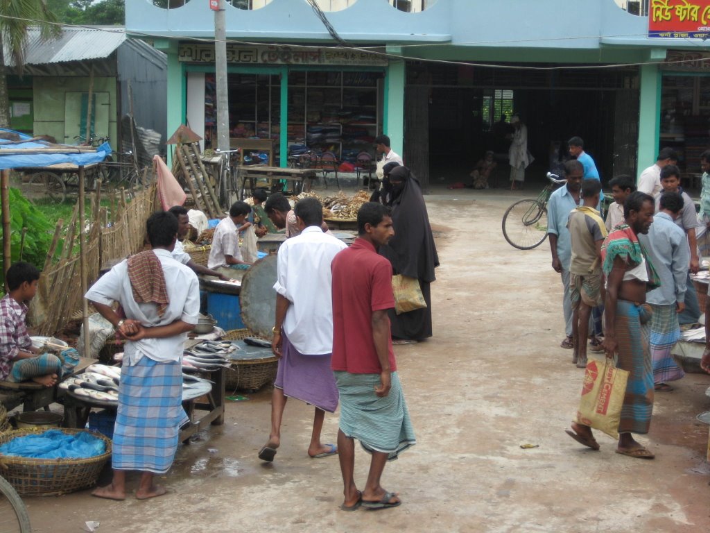
| People of Chandpur in a Lower Class Market |
Demographics:
Population:
Chandpur district has an estimated population of 2,808,000, 49% male and 51% female.
Income and occupations:
Wages in Chandpur district are often less than US$1 per day, which is below the international poverty line of US$1.25 per day. Poverty in Bangladesh is highest amongst coastal regions, with Chandpur district recognized by the Water Resources Planning Organization (WARPO) as one of the country's poorest areas. The majority of Chandpur district's residents are employed in manual labor, with the population engaged in the following industries:
- agriculture (35.13%)
- fishing (3.03%)
- agricultural labor (20.04%)
- wage laboring (3.15%)
- private commerce (12%)
- transportation industry (2.24%)
- construction industry (1.64%)
- service industry (11.68%)
- other occupations or industries (11.09%)
 |
| A Masjid in Chandpur, Bangladesh |
Religion:
In 1991, the district of Chandpur comprised the following:
- 3620 Islamic mosques
- 128 Hindu temples
- 16 Buddhist temples
- 3 Christian churches
Within the Chandpur district population, 92.55% identified as Muslim, 7.18% as Hindu, 0.06% as Buddhist, 0.07% as Christian and 0.14% as having animist beliefs.
Land ownership:
As Chandpur district is one of the most economically deprived divisions in Bangladesh, there is a significant percentage of landless people (27%) whose primary form of income is earned through wage labor. A similar number (27%) of low wage earners who engage in subsistence agriculture are marginally landless, 39% of people own a small plot of land and 10% of people own land of an intermediate size. The remaining majority of land in Chandpur district is owned by a wealthy 2% of the population.
 |
| Hassan Ali Government High School Chandpur |
Literacy:
Chandpur district has an average literacy rate of 50.29%, which is slightly lower than the average Bangladeshi literacy rate of 55.9%. A slight gender imbalance is reflected in Chandpur district's overall literacy rates, with statistics showing 51.9% amongst males and 48.74% amongst females.
Culture:
Archaeological artifacts and relics:
The history of Chandpur district is reflected in its many remaining cultural, social and religious relics. Many of Chandpur district's most enduring artifacts represent the different periods of British, Hindu and Islamic influence in the region, with some of most well known being:
- Shah Rasti Dargah
- Begum Mosque
- Hajiganj Bara Mosque
- Suja Mosque
- Alamgiri Mosque
- Mada Khan Mosque
- Kali temple, Matlab
- Lohagara ashram
- Naorai ashram
- Tultuli (Kachua) ashram
- Ancient chariots, Sachar and Matlab,
- Ancient fighting swords of Behula Ujani
- Remnants of the Nasir Court fort
- Kali temple, Meher
- Neelkuthi, Shahebganj
- Baraduara, Kasimbazar
- Kali temple, Mandir, Chandpur Sadar
- Manasha mura, Kachua
 |
| Chandpur Pouro Eid Ground |
A diversity of cultural organizations, community centers and public access spaces exist within Chandpur district. These include:
460 clubs
9 public libraries
12 cinemas
14 theater groups
5 literary societies
2 parks
45 youth organizations
3129 cooperative societies
451 voluntary organizations
15 women's organizations
Media:
Newspapers and periodicals:
A variety of local newspapers, magazines and periodicals are available in Chandpur district. Current print media resources include:
- Daily Chandpur Kantha
- Dainik Chandpur Darpan
- Weekly Chandpur
- Weekly Chandpur Sangbad
- Weekly Rupasi
- Weekly Dibachitra
- Weekly Hajiganj
- Weekly Manabsamaj
- chandpur somoy

Infrastructure:
Educational institutions:
The government of Bangladesh operates a three-tiered and highly subsidized educational system. Many primary, secondary and higher secondary level schools are fully state funded, additionally some private schools are partially subsidized by the government. In the tertiary education sector, the Bangladeshi government also funds more than 15 state universities through the University Grants Commission.
Within the Chandpur district there are a wide variety of educational institutions, including:
- 1 university
- 2 government colleges
- 36 non-government colleges
- 1 teacher training institute
- 6 government high schools
- 224 non-government high schools
- 1157 madrasahs
- 786 government primary schools
- 684 non-government primary schools
- 76 mass education schools
- 28 BRAC schools
- 61 community schools
- 37 satellite schools
- 11 kindergartens
- 1 deaf-mute government school
 |
| Al- Ameen Academy, Chandpur, Bangladesh |
Some of Chandpur district's most recognized educational institutions include:
- Al-Amin Academy School and College
- Chandpur Government College
- Chandpur Government Girls College
- Protyashi R.A High School
- Hasan Ali Government High School
- Matripith Government Girls High School
- Jeeb Gaon General Haque High School, Matlab North, Chandpur
- Jagatpur High School, Kachua, Chandpur
- Nischintapur high school and college, Matlab north
Health centers:
Access to health care in Bangladesh is relatively limited; although, some statistics have suggested that with a reduction in the rate of poverty, documented at 31% in 2010, more Bangladeshis are able to access health care services.
 |
| A Village in Chandpur, Bangladesh |
Bangladeshis who survive on subsistence agriculture and reside in villages face the most barriers in accessing health care services. In rural areas such as Chandpur district, village doctors with little or no formal training constitute 62% of the healthcare providers practicing modern medicine; whilst tertiary trained healthcare providers, who constitute 4% of the total health workforce, are highly inaccessible to rural dwellers. Consequently, case studies suggest that up to 70% of village dwellers who consult a healthcare provider for curative services are most likely to contact a village doctor.
Many of the primary health care issues in Bangladesh are preventable, and result from poor water quality and a high prevalence of infectious diseases such as malaria, leptospirosis and dengue. Bangladesh's water crisis involves widespread bacterial contamination of surface water and arsenic contamination of groundwater.
 |
| Chandpur General Hospital |
The poor health care conditions in Bangladesh are ultimately attributed to a lack of services provided by the current Bangladeshi government. According to a World Bank report published in 2010, in 2009 the total expenditure on health care was 3.35% of the country's GDP, and there were 4 hospital beds per 10 000 people. Resultantly, Bangladeshi citizens are responsible for 96.8% of their health care expenses.
As they are located in one of Bangladesh's most economically deprived areas, Chandpur district's health care facilities are limited to:
- 1 zila sadar hospital
- 1 charitable dispensary
- 7 upazila health complexes
- 20 satellite clinics
- 76 health and family welfare centers
- 3 maternity centers
- 1 eye hospital
- 1 diabetic hospital
- 1 Red Crescent hospital
- 1 tuberculosis hospital
- 6 private clinics
- 1 Railway hospital
 |
| Chandpur Railway Station |
Transport:
Roads:
The quality of Bangladesh's roads vary considerably, with a diverse network of sealed, partially sealed and unsealed roads common to every administrative district within the country. Chandpur district's roads consist of 215 kilometres (134 mi) of sealed roads, 91 kilometres (57 mi) of partially sealed roads and 1,407 kilometres (874 mi) of unsealed roads.
Railways:
Bangladesh Railways utilize a small metre gauge track, with 50 kilometres (31 mi) of railway tracks spanning the Chandpur district. The Chandpur-Laksham train line culminates in a major terminus station at Chandpur town.
 |
| Chandpur Launch Terminal, Chandpur, Bangladesh |
Waterways:
Chandpur district is connected with the rest of Bangladesh by a network of coastal water routes, with waterways in the district spanning 190 nautical miles.
Coastal vessels carry bulk cargo from districts within Chittagong, including Chandpur district, to other important trading centers in the country. The most common commercial items transported by waterways are fuel, oil, cement, food grains and salt. Passenger services along Bangladesh's coastal water routes are not very popular due to their well known poor safety record.
Traditional transport:
Traditional means of transport in the Chandpur district included the palanquin, bullock cart and horse drawn carriage. However, with the advent of rickshaws, buses, bicycles, automobiles, railway systems and air travel, traditional modes of transport in the Chandpur district are either extremely rare or extinct.PalanquinA palanquin, also known as palkhi, is a covered sedan chair (or litter) carried on four poles by hired staff or servants.
 |
| Beautiful Landscape of Chandpur |
The word "palkhi" derives from the Sanskrit word for a bed or couch, "pa lanka". Prior to the establishment of a railway system across the Indian subcontinent, palanquins were a luxurious method of travel used by wealthy merchants, noble men and women, European colonialists and members of the upper classes. With the exception of Hindu wedding ceremonies and Hindu religious rituals, palanquins are rarely used in Chandpur district in the twenty-first century.
Economics:
Manufacturing plants:
The manufacturing industry within the Chandpur district includes the following plant types:
- 11 jute mills
- 185 rice and flour mills
- 14 ice factories
- 4 cold storage plants
- 1 industrial chemical factories
- 3 iron workshops
- 1 aluminium production plant
- 3 match factories
 |
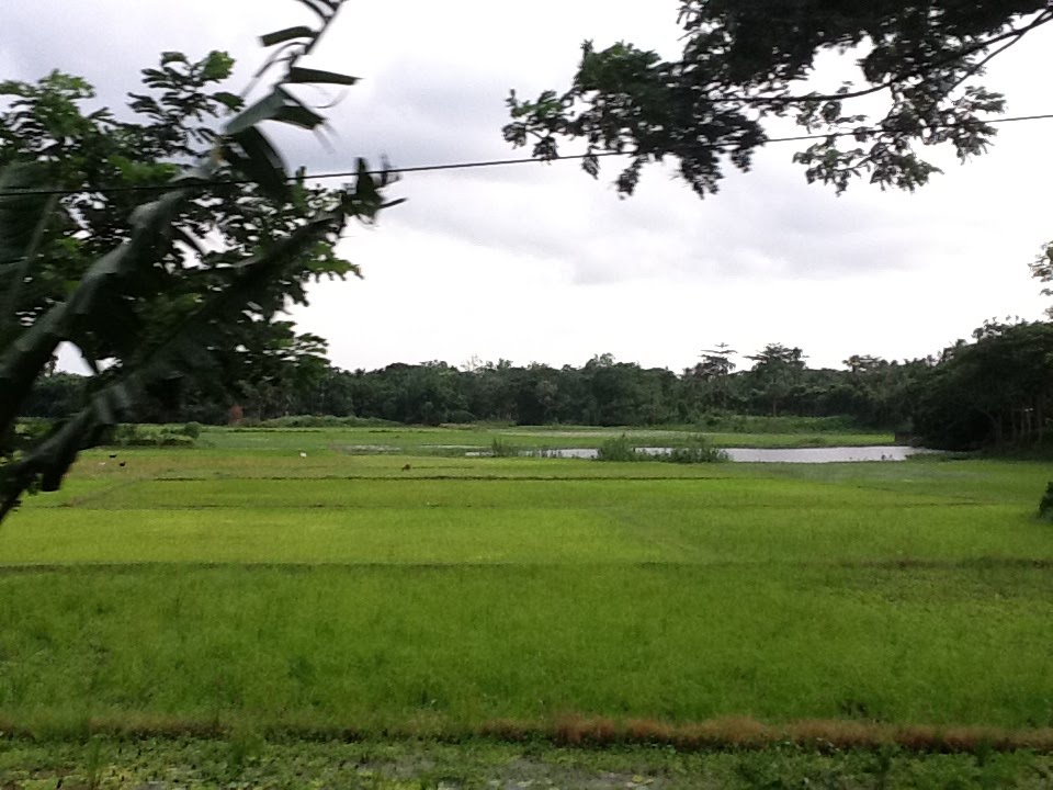
| A Paddy Field in Chandpur, Bangladesh |
Cottage industries:
Cottage industries in Chandpur district include:
- weaving
- specialist mat making
- pottery
- bamboo and cane work
- weaving fishing nets
- blacksmiths
- tailoring
- goldsmith
Agriculture:
Crops commonly grown in the Chandpur district include:
- rice paddy fields
- jute
- mustard seed
- betel nut, or paan (known locally as supari nut)
- wheat
- potato
- sugarcane
Formerly, linseed, sesame, local varieties of rice and dal (pulse) were also important crops.
 |
| Hilsa Fish Catching in Chandpur |
Fruits cultivated within the Chandpur district include:
- mango
- jackfruit
- banana
- papaya
- coconut
- sugar date palm
- guava
Within the Chandpur district there are also a number or fisheries, dairies and poultry farms.
Main exports:
Chandpur district's main exports include:
- hilsa fish
- shrimp
- betel nut
- potato
 |
| Puran Bazar Chandpur |
Bazaars and fairs:
In Chandpur district there are a total of 213 bazaars, the most notable of which include:
- Puran Bazaar
- Natun Bazaar
- Baburhat Bazaar
- Kachua Bazaar
- Jagatpur Bazaar
- Faridganj Bazaar
- Fatehpur Bazaar
- Suchipara Bazaar
- Begum Bazaar
- Hajiganj Bazaar
- Warukh Bazaar
- Matlab Bazaar
- Shahtali Bazaar
- Satnal Bazaar
- Austami Snan Mela (Chandpur)
- Meher Kali Mela (Shahrasti)
- Paush Samkranti Mela
- Bijoy Mela
- Asutami Mela (Aliganj, Hajiganj)
- Lengtar Mela (Badarpur, Matlab)
- Boi Mela.
 |
| Agricultural Land in Chandpur |
Land:
Land uses:
The total land mass for agricultural cultivation in Chandpur district is 167,009 hectares.
This land includes:
- 112,210 hectares of cultivable land
- 48,311 hectares of fallow land
- 60,921 hectares of land with in-ground irrigation systems
- single crops (15.03%)
- double crop (59.93%)
- treble crop (25.04%)


 Chandra Imam Ali High School and College Chandpur, Bangladesh


 Faridganj, Chandpur, Bangladesh


 Haimchar, Chandpur, Bangladesh


 Hajiganj, Chandpur, Bangladesh


 Kachua, Chandpur, Bangladesh


 Matlab Bazar, Chandpur, Bangladesh


